01
Infrastructure
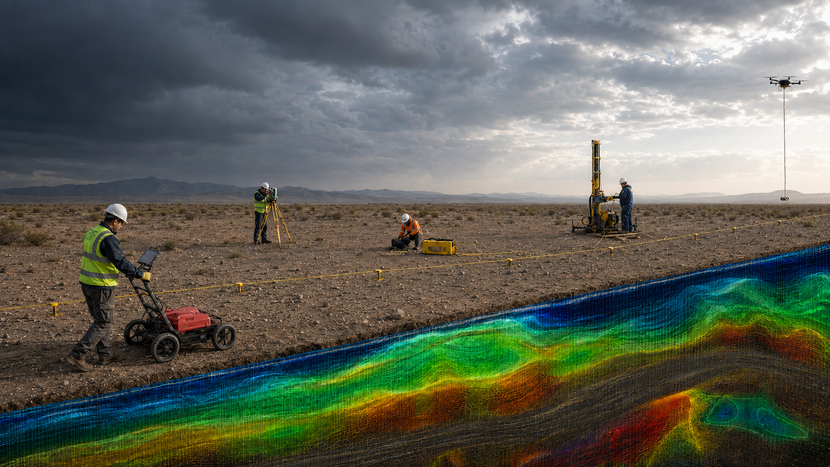
Reduce uncertainty before design, excavation and construction through targeted subsurface investigation and integrated interpretation.
GPR · ERT · MASW · Seismic Refraction · UAV LiDAR↗Applied geoscience
Integrated geophysical, geological and geospatial solutions to reduce subsurface uncertainty, prioritize investigation targets and support better engineering, environmental and exploration decisions.
U.S. market entry in preparation
What we deliver
J.W. Castle Geoscience is being structured to help clients reduce subsurface uncertainty before committing to costly drilling, excavation, remediation or design decisions. Each scope is built around the decision to be made, combining fit-for-purpose investigation, documented QA/QC and integrated interpretation into clear, actionable deliverables.
See our technical approach ↗01
Reduce uncertainty before design, excavation and construction through targeted subsurface investigation and integrated interpretation.
GPR · ERT · MASW · Seismic Refraction · UAV LiDAR↗02
Improve groundwater decisions by defining aquifer geometry, identifying priority zones and integrating geophysical, geological and well data into practical conceptual models.
ERT · Well Data · GPR · 3D Conceptual Modeling↗03
Support delineation, remediation and redevelopment decisions by improving subsurface characterization and reducing uncertainty around environmental targets.
ERT · GPR · Data Integration · Monitoring↗04
Prioritize exploration targets, refine subsurface geometry and reduce drilling uncertainty through integrated geophysical, geological and geospatial evidence.
MAG-UAV · IP · Gravimetry · Gamma Spectrometry↗The Castle standard
A decision-focused workflow connects project objectives, field investigation, QA/QC, interpretation and actionable recommendations.
Define the decision to be supported, the target, project constraints and the evidence already available.
Select the methods that can most effectively reduce uncertainty and acquire the required field evidence.
Apply documented QA/QC and integrate geological, geophysical, geospatial and existing project data.
Deliver auditable maps, sections, models and recommendations that support prioritization, design and next-step decisions.
Selected field records and technical results from the founder's prior experience.
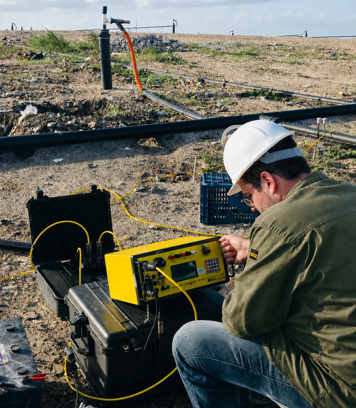
Field configuration and quality control during electrical resistivity and induced polarization data acquisition.
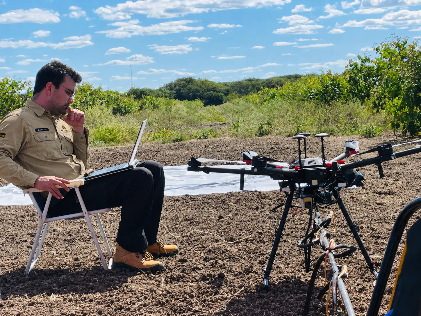
Pre-flight verification and field monitoring for UAV-based magnetic surveying in an open terrain environment.
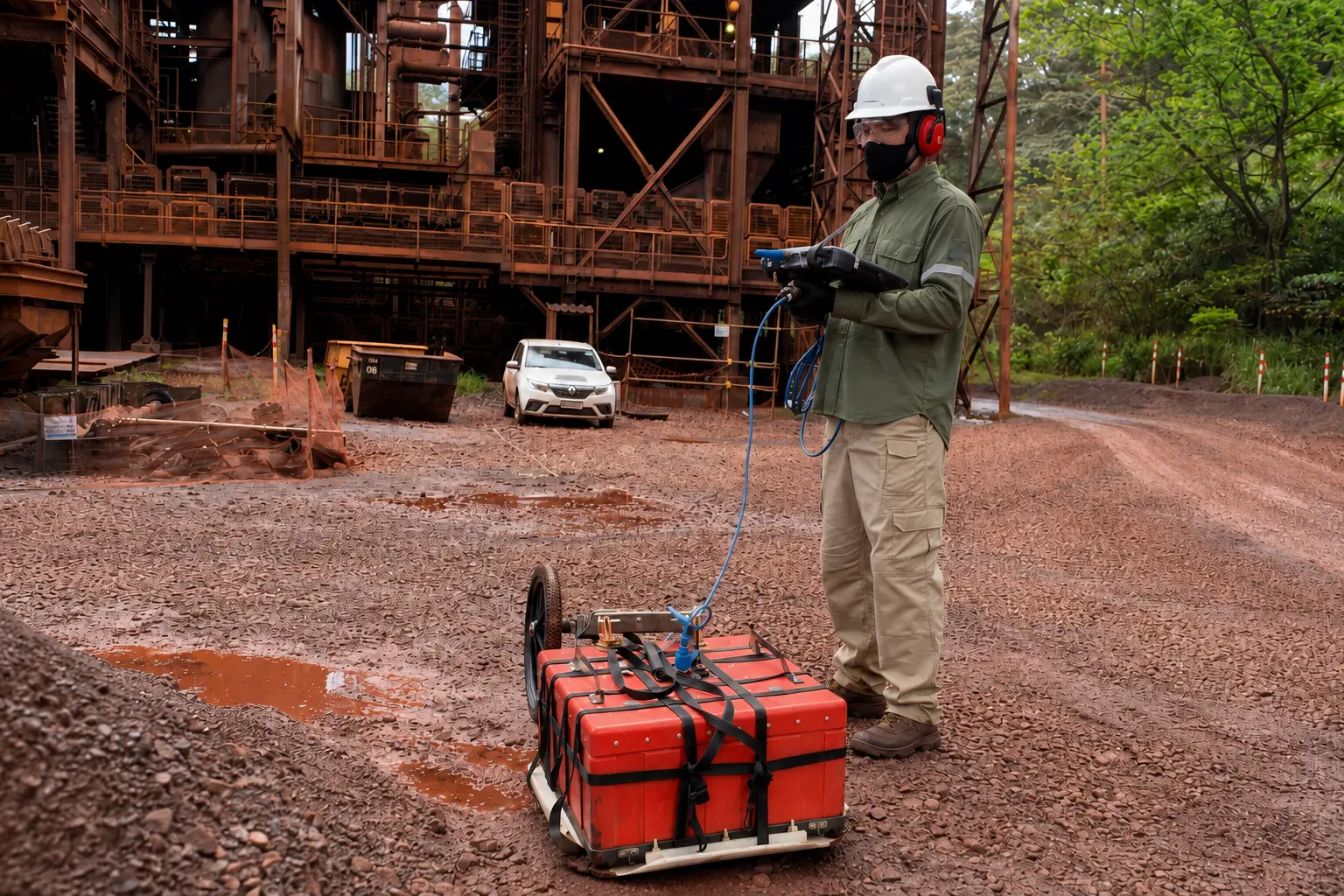
Ground-penetrating radar acquisition performed under controlled industrial and safety conditions.
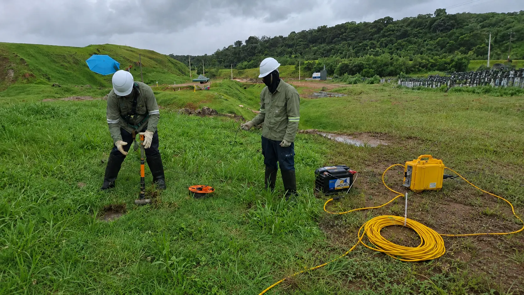
Field deployment for seismic refraction and MASW surveys, supporting subsurface velocity characterization and engineering assessment.
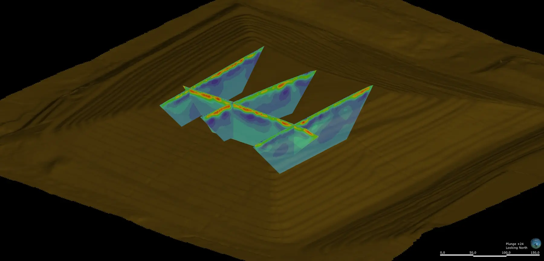
Three-dimensional integration of electrical resistivity sections with terrain data for spatial interpretation.
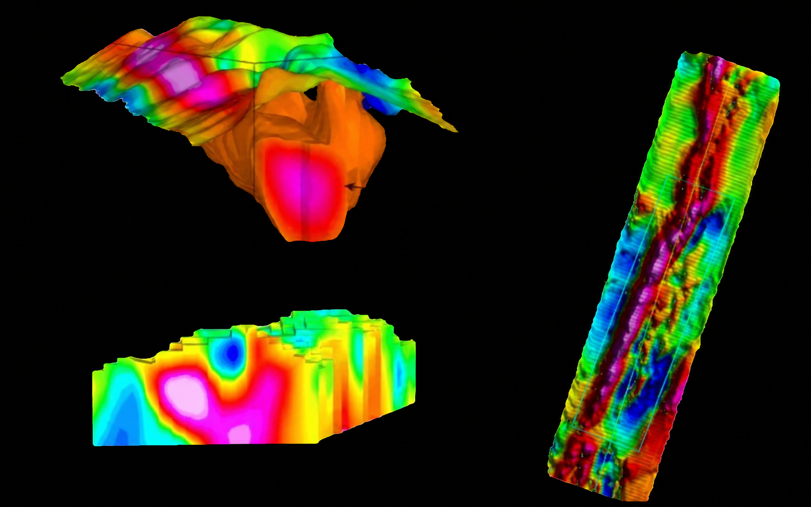
Magnetic processing and three-dimensional modeling used to evaluate anomaly geometry, depth and exploration targets.
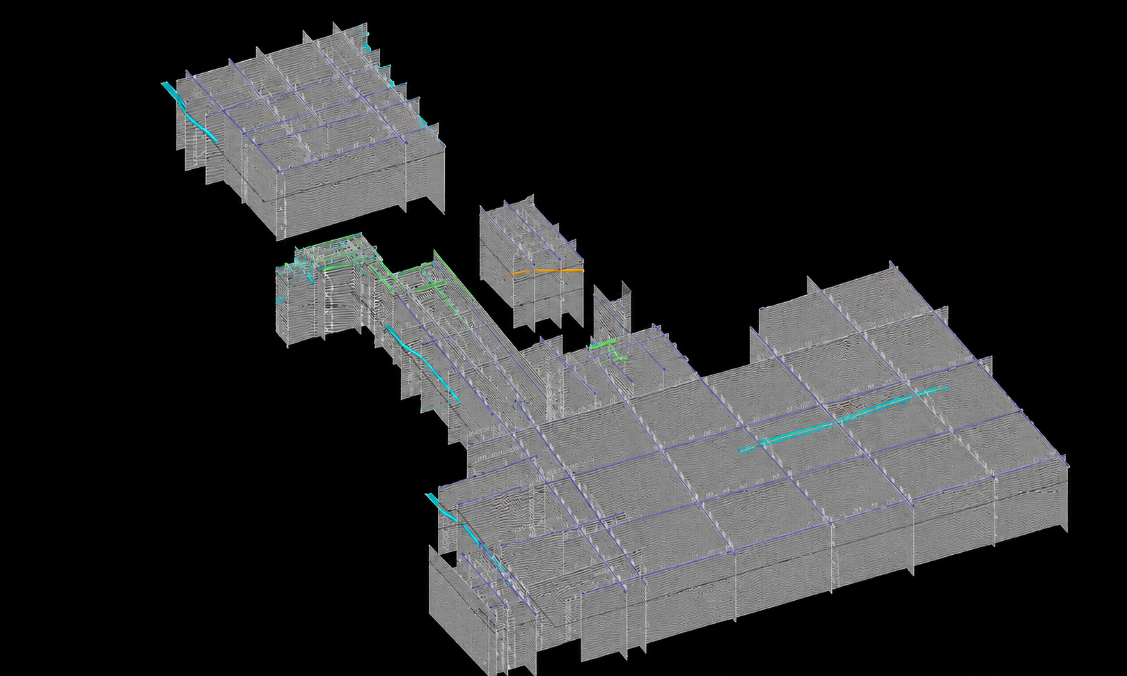
Multiple GPR profiles assembled in a spatial framework to visualize subsurface continuity across the surveyed area.
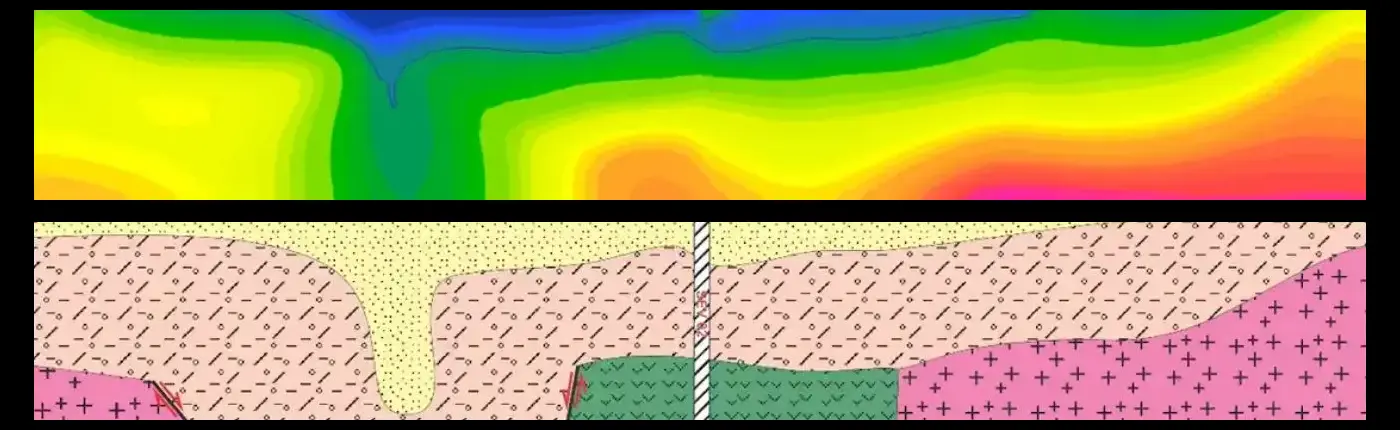
Integrated seismic velocity modeling and geological interpretation used to characterize subsurface layering, lateral variations and engineering-relevant interfaces.
Founder-led expertise
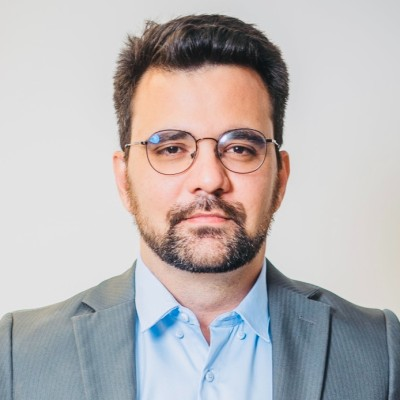
J.W. Castle Geoscience is a proposed U.S. venture led by geologist Jonathan Lima Castelo Branco, who brings 10 years of experience delivering geoscientific projects across Brazil. His background combines applied geophysics, technical operations, innovation and business leadership across mining, infrastructure, hydrogeology and environment projects.
The U.S. market entry is designed around collaboration with engineering firms, environmental and hydrogeological consultancies, mining companies and prime contractors that need specialized geophysical support, additional technical capacity or integrated subsurface interpretation for clearly defined project scopes.
J.W. Castle Geoscience is intended to complement existing project teams rather than replace them, bringing specialized field, processing and interpretation capability when additional geoscience expertise is required.
Partnerships & opportunities
We welcome conversations with engineering firms, environmental and hydrogeological consultancies, mining organizations and technical providers seeking specialized geophysical support, complementary field capacity or integrated subsurface interpretation.
Potential collaboration may include subcontracted geophysical surveys, specialized processing and interpretation, multi-method data integration and technical support for project-specific investigation needs.
Start a conversation ↗